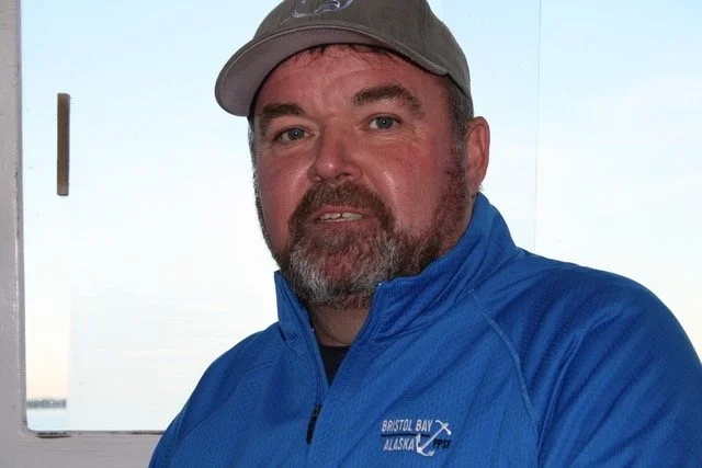
100 MPH Process: Fisherman Dewey Hemilright of Wanchese, NC on Wind Energy
Reprinted from Tradewinds Magazine, 2022 by B. Garrity-Blake. Photo courtesy of Worth Elliott
“Sometimes I wish I wasn’t so entrenched in this stuff,” commercial longline fisherman Dewey Hemilright said. “It’s hard to turn my mind off.” Hemilright, who fishes out of the northern Outer Banks village of Wanchese, serves on the federal Mid-Atlantic Fisheries Management Council as well as numerous advisory committees. Lately he has turned his attention to offshore wind energy and its potential impacts on fisheries, including commercial, recreational, and for-hire charter businesses.
“I don’t think people understand the magnitude of these wind energy areas from Maine to South Carolina -- a massive amount of acreage if you add it all up, and what a disruption to the seafood industry this could be,” he said. “And the leases are going for such huge amounts of money I worry that the commercial fishing industry will amount to a grain of sand on Jockey’s Ridge.”
Hemilright calls the recent acceleration in ocean bottom leasing a “100 mile-per-hour process.” Indeed, a market report outlining activities of the U.S. Bureau of Ocean Management (BOEM) stated that “2021 will be remembered as the transformational year that kickstarted U.S. offshore wind.” In February 2022, six companies successfully bid for leases in the New York Bight lease area for a total of $4.37 billion, the highest grossing lease sale in history. A whopping of 3.9 million acres is under review for leasing in the Central Atlantic region. BOEM is only just now calling for input on a draft mitigation strategy to address wind energy development impacts to the commercial and recreational fishing industry; guidelines will be released late summer of 2022.
“There’s already 33 leased sites on the east coast,” Hemilright said. “I call that putting the cart before the horse.” He’s especially concerned about the 3.9 million Central Atlantic proposed region, as it includes “Call Area F” in federal waters off Virginia and northern North Carolina. Area F is just northeast of an ecologically unique and fisheries abundant system known as the Point, where the northern Labrador Current meets the southern Gulf Stream. This juncture of currents is a key fishing area for Wanchese-based pelagic longline crews who fish for highly migratory species like tuna and swordfish, and whose gear drifts into Area F.
“I did a data request from the state of North Carolina for landings from dealers in Dare County,” Hemilright said. “In 2021, dealers landed 1.3 million pounds of swordfish, yellowfin tuna, and big eye tuna. Converted to carcass weight that’s about 1.1 million pounds, which is around $10 million in value by the time it gets to the consumer’s plate.” He explained that the port of Wanchese is home to the entire pelagic longline fleet of North Carolina because fishermen have lost access to Morehead City and Beaufort marinas that have transitioned to recreational use only. The 15-vessel fleet is made up of relatively small boats limited by a maximum six- or seven-foot draft thanks to Oregon Inlet shoaling.
“For pelagic long line boats, the only place to work out of in North Carolina is Wanchese, so I worry about our survival,” he emphasized. “If Area F off here gets leased in 2023 and we get kicked out, we’re talking about adverse effects on the whole North Carolina fleet, which is 25% of the entire 60-boat fleet from Maine to Texas. That’s why it’s vital we don’t have wind turbines built in these productive fishing grounds near the Point."
Dewey Hemilright is not one to complain from the sidelines. He's been pulled into the wind energy process due to his experience as a commercial fisherman. Part of BOEM’s “Best Practices” calls for enlisting a “Fisheries Liaison” (FL) and a “Fisheries Representative” (FR); the former shares information and conducts public outreach, while the latter represents the local fishing port and vets information. Hemilright was contracted to be the Fisheries Representative following the leasing of a site to Avangrid Renewables in federal waters off the northern Outer Banks.
“Once a company gets the lease they start determining what’s out there,” Hemilright said. “I got hired as Fishery Rep for Avangrid’s Kitty Hawk Wind proposal, working with Fishery Liaison Rick Robbins who used to be chairman of the Mid-Atlantic Council. Basically we data-mined.” For eighteen months the pair collected all available fisheries data for the area, including federal, state, and oral history accounts going back several decades.
“The Liaison had me look at data and models, and asked me how accurate I thought they were,” Hemilright said. “I was able to use my knowledge as a fishermans and experience working with all these management councils and commissions – I could say, ‘Look at this data, this don’t look right. Not possible, they ain’t in there dragging.’ My job was to answer fisheries questions about what was in the area – we found that the Kitty Hawk Wind area was more of a pass-through than a targeted fishing ground.”
Although Hemilright is glad that fisheries experts are consulted as sites get leased, he’s concerned that the process is happening too fast, and that available data is not fine scale enough to adequately assess the impact of wind energy development on fisheries.
“My biggest concern is that we have data for the 30-thousand-foot view, but not on the 100-foot level for these areas – it’s a deficiency of data of who’s catching what and where they’re catching it. It’s crazy that in 2022, we ain’t tuned up to that. We should have been gathering this data for stock assessments – even before we thought about wind.”
Hemilright questions BOEM for going full speed on leases before the appropriate fisheries catch data is available. “Our own agency, fisheries, will tell you they haven’t gathered the data we need because they don’t have the funding,” he said. “Data 101 should be what species are you catching, where are you catching them, and at what time of year, so we’re drilling down for more accurate data.”
Some fisheries, like the pelagic longline fishery, require a high level of monitoring that yields detailed fishing data. “We have vessel monitoring systems (VMS), cameras, trip reports, observers. VMS data shows where you set your gear and where you retrieve it, but NMFS hasn’t generated that data for these leases because of time constraints and resources. All they provide is fishermen’s logbook set data, and that leaves out where you retrieve your gear, which can be 10 - 50 miles away because of the Gulf Stream effect.”
Other fisheries, such as the South Atlantic snapper grouper fishery (potentially affected by a wind project developing off Wilmington), generate less-specific data. Snapper-grouper fishermen are required to record their harvest locations within a grid of 60 square mile blocks.
“You just write down a block number,” Hemilright explained. “You could be fishing anywhere in those sixty square miles. Hey, I don’t need to know your fishing spot, but how about we narrow it down to a ten-mile area instead of sixty?”
The worst deficiency in catch data concerns the recreational fishery. “The recreational fishing industry is so massive. Yet we do not know with any certainty how much fish they catch and where they catch it,” Hemilright said. Unlike commercial fishermen who are required to report catch and landings data, recreational anglers are not required to report anything. “NOAA Fisheries has a recreational data collection program called MRIP (Marine Recreational Informational Program), which sends people out to randomly sample anglers at the dock or by phone or mailed surveys. Then they compile that data and make estimates, which are less than reliable -- the numbers for recreational fishing impacts are not precise by any means, and that includes the for-hire charter industry.”
Dewey Hemilright, like many commercial fishermen, is practical-minded, and finds it mind-boggling how slow and inflexible the management process can be. “My thinking comes from turning that key of the boat, and knowing if that engine don’t start we've got to fix it or we can't go fishing."
So why doesn’t the government fix the problem and take steps to ensure that better data is collected?
“We’ve got a messed up system here, and to my knowledge the system does not want changing or fixing,” Hemilright said. “NOAA’s Southeast Regional Office, their Greater Atlantic Regional Office, and the federal Councils need the intestinal fortitude to make hard decisions so we can account for the recreational industry and get accurate data across all fisheries."
Hemilright thinks the government's lag in fixing the fisheries data problem is in stark contrast to the lightning speed of their leasing process, and this will come back to bite fishermen as wind energy efforts ramp up. "I think it’s crazy how we’re going full bore on wind energy projects when we don’t know who's using the ocean, where people are fishing, and what they’re catching.”
Hemilright pointed out that all fishing boats – from small skiffs and outboards to large trawlers and million-dollar sportfishing vessels -- are fossil fuel-dependent. By the same token, U.S. commercial fishermen abide by some of the world’s strictest conservation measures and management practices to supply the public with seafood. In fact, a 2016 study ranked the United States as first in the world according to a Fisheries Management Index of healthy fisheries and sustainable fishing practices. If wind farms displace commercial fishermen, would the government not be trading one renewable resource for another?
“We talk about all this renewable energy, great, we can save the world,” Dewey Hemilright reflected. “But what do we do in the meantime? You close these fishing areas for wind farms, we’ll lose fishermen, fish houses, trucking services – our seafood infrastructure. Then we'll end up importing even more seafood than we do now from countries that don’t have to play by the same environmental rules we do. You call that sustainable?”